
Backroad Destination: Highway 20, Lower Methow River Valley, Washington
This weeks backroads adventure is the lower Methow River from where it joins the Columbia River up to the town of Winthrop. See previous blog for Winthrop and Chewuch River country: Winthrop and Chewuch River .
Highway 20 is one of the scenic highways of Washington state. Everybody exploring the northwest should drive the highway. The portion downstream of Winthrop has limited public opportunities, yet most people will have to drive this area. So here are some of the boondocking and things to do!
The first site is right on the mouth of the Methow River. It is managed by Douglas County Public Utility District. It is right on the road and you are wedged between the river and the highway. However, it is free and there are toilets, When we were there is was crowded with a amateur ham radio group all camped together. Normally the site is lightly used until October when the steelhead fishing season opens.
Max size for trailer is 38 feet. At the end of the road is a horse packer that offers rides right from that area.
Further west you will run into the bustling little town of Methow. The Methow Cafe or Kim's is a good stop for breakfast. We had Sunday dinner there complete with a live band playing string acoustic jazz music of the 1930's Paris, France. Nice stop.

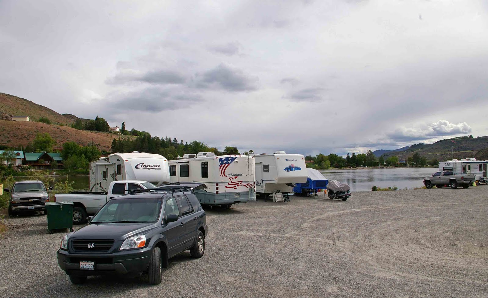
Here is the view of the camping area.

Not the best design, but it is functional. I suppose this is what a Wal-Mart parking lot would look like if they used rocks instead of paint! Here are the co-ordinates for this spot: 48 09 04.08 N 120 03 25.74 W
Yes, if you zoom in on the spot with Google you will see the rocks in the parking area.
After passing through Methow you reach the town of Carlton complete with its own mall! The mall might have fallen on hard times and is probably still closed. Just to show the Carton has not forgotten its past it still has its General Store. The Fish and Wildlife access at this time allows camping in the site, but it is a crowded spot right in town. Co-ordinates are: 48 14 45.68 N 120 07 04.82 W
As you head further upriver you will see the sign for BlackPine Campground. This is a small, very tight Forest Service Campground not suitable for trailers. Here is a picture of the campground on a rainy day. For tent campers it is a nice place particularly if they have kids.

The road then heads into Twisp and Winthrop, Twisp is a nice town. Here is a link to a newspaper article on the town and its attractions: Twisp Information .
Our favorite place in Twisp is the Twisp River Pub. Good food, good brews, good art, good music. What more do you want in stop for lunch or dinner? Twisp River Pub website
This area of Highway 20 is one that people tend to drive through. If you find you want to linger awhile in the area we recommend camping at Alta Lake or one of the private campgrounds in the lower valley.
We will cover the Twisp River area managed by the Forest Service in the near future. It is just south of the town of Twisp. It is complete with campgrounds, boondock areas, and hiking trails. Nice area. It merits its own blog entry. It is only about 20 miles outside of town. You could also stay there and "commute" into town.

No comments:
Post a Comment